
 换一换
换一换 


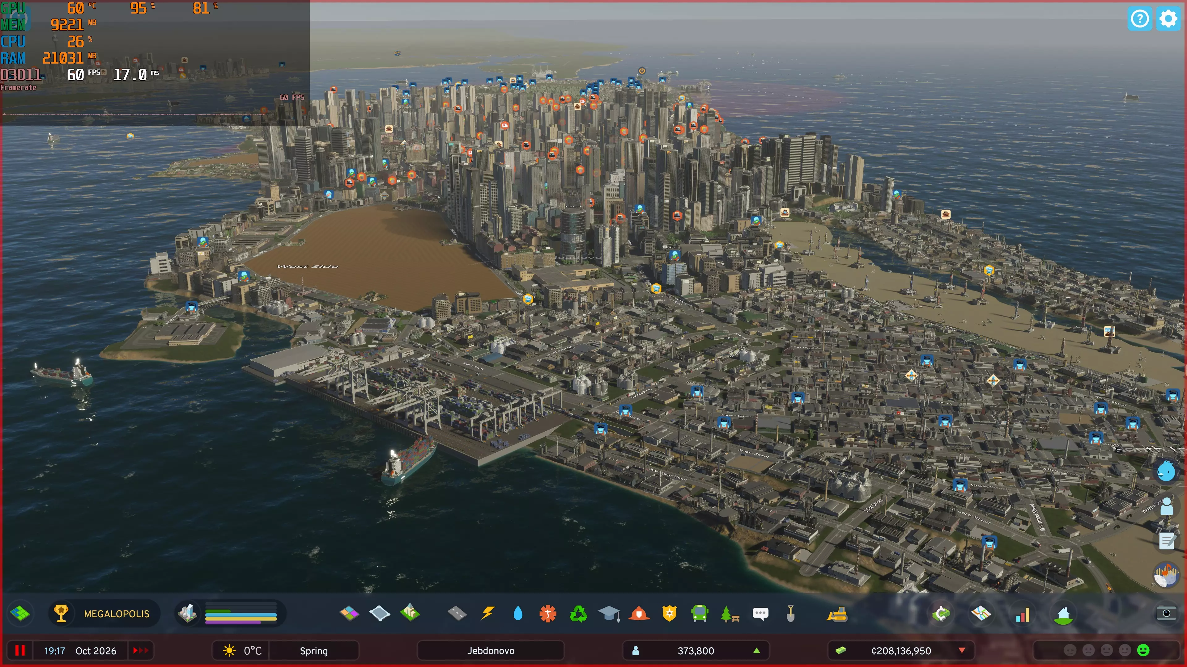
This guide will dive deep into every transit option, providing optimal configurations, placement strategies, and integration techniques that I've perfected across hundreds of hours of gameplay. Introduction Road networks alone won't save your city from traffic nightmares in City Skylines 2. The game's sophisticated simulation means citizens will make complex transportation choices based on time, cost, and convenience. Alternative transit systems are not merely decorative—they're essential infrastructure that can transform your city's efficiency, reduce pollution, and dramatically improve your citizens' happiness. This guide will dive deep into every transit option, providing optimal configurations, placement strategies, and integration techniques that I've perfected across hundreds of hours of gameplay. Public Transit Fundamentals Before we dive into specific transit types, understand these universal principles: The Transit Hierarchy Like road networks, transit systems work best with a hierarchical approach: Local service (buses, trams): Short routes, frequent stops, neighborhood coverage District connectors (metro, monorail): Medium routes, moderate stops, connecting districts Regional transport (trains, ferries): Long routes, few stops, connecting distant areas Intercity links (airports, harbor): External connections with minimal internal stops The Critical Coverage Formula For maximum efficiency, follow the 80/40/15 rule: 80% of residential areas should be within 800 units of any transit stop 40% of stops should connect to at least one other transit type 15% maximum capacity usage during non-peak hours ensures adequate peak capacity Understanding Cost Efficiency Each transport type has a cost-to-passenger ratio that determines its efficiency: Buses: $15-20 per passenger-km (most expensive per passenger) Trams: $8-12 per passenger-km Metro: $5-7 per passenger-km Trains: $3-5 per passenger-km (most cost-effective for long distances) Bus Systems: The Foundation of Transit Despite being the most basic transit option, buses are vital for comprehensive coverage. Optimal Bus Network Design Hub-and-Spoke: Create central bus terminals in each district with routes radiating outward Circulator Routes: Ring-shaped routes around commercial and high-density areas Express Routes: Limited-stop buses between major destinations Advanced Bus Techniques Dedicated Bus Roads: Create roads only buses can use to bypass congestion Bus Priority Lanes: On six-lane roads, dedicate the innermost lane to buses Optimal Stop Spacing: 300-400 units between stops in high-density areas, 500-600 in low-density Timed Transfer Points: Create hubs where multiple routes arrive simultaneously for easy transfers Bus Depot Placement Position bus depots strategically: On the edge of high service areas With direct access to arterial roads Away from residential areas (noise pollution) With a dedicated exit that doesn't interfere with regular traffic Tram Systems: Surface Rail Excellence Trams combine the accessibility of buses with higher capacity and passenger appeal. Tram Network Planning Grid Coverage: Create a grid network in downtown/commercial districts Avenue Integration: Place trams in the median of large avenues Dedicated Corridors: Create tram-only roads in high-density areas Technical Specifications Optimal Track Spacing: 800-1000 units between parallel lines Stop Interval: 350-450 units between stops Turning Radius: Avoid 90° turns when possible; use curve tool for smooth corners Intersection Priority: Set traffic policy to prioritize trams at intersections Tram Depot Integration Unlike CS1, tram depots in CS2 require more strategic planning: Connect to the main line with switches on both sides to prevent bottlenecks Create small storage loops for trams waiting to enter service Position near the center of your tram network to minimize deadheading Metro Systems: Underground Capacity Kings Metro systems are the workhorses of dense urban areas, moving massive numbers of citizens without consuming surface space. Metro Network Architectures Radial System: Lines extending from central hub (best for centralized cities) Grid System: Perpendicular lines creating transfer opportunities (best for even density) Circle Line: Peripheral route connecting outlying districts (reduces central congestion) Station Placement Science The success of your metro hinges on station positioning: Place stations at intersections of pedestrian heat maps and traffic flow Ensure 80% coverage of high-density residential and commercial Create intermodal transfer points with surface transit every 3-4 stations Use the "pedestrian path overlay" to optimize entrance/exit placement Capacity Optimization Train Frequency: 2-3 minutes between trains during peak hours Line Balancing: Ensure similar passenger loads across all lines Express Service: On longer lines, implement express trains that skip minor stations Transfer Design: Stacked or adjacent platforms minimize walking distance between lines Technical Tunneling Tips Keep tunnels between 10-15 units below ground to minimize construction costs Maintain a minimum curve radius of 40 units for stable high-speed operation Use tunnel terrain leveling tools to create gentle grades (max 8% slope) Implement bypass tunnels at busy transfer stations Monorail Systems: Mid-Capacity Elevation Often overlooked, monorails occupy a perfect middle ground between metros and trams. Strategic Implementation Complement Metro: Use monorails where metros would be overkill Elevated Corridors: Run above major avenues without disrupting traffic Tourist Circuits: Connect major landmarks and tourist attractions Technical Superiority Construction Cost: 30% cheaper than metro for similar capacity Visual Range: Provides passive tourism boost to buildings within 200 units Noise Profile: 40% less noise pollution than elevated metro Speed Advantage: 15% faster than trams with similar stop frequency Integration Techniques Connect monorail stations directly to shopping centers and office buildings Create elevated walkways between stations and major destinations Use monorail as intermediate capacity between bus and metro Train Systems: Regional Connectivity Masters Trains excel at connecting distant districts and handling massive passenger volumes. Passenger Rail Network Design Spine and Branch: Main line with branches to districts (best for linear cities) Multiple Hubs: Several interconnected stations (best for distributed cities) Bypass Routes: Express tracks around congested areas Train Station Hierarchy Implement a three-tier station system: Central Terminals: 8-16 platforms, full intermodal connections, downtown locations District Stations: 4-6 platforms, bus/tram transfers, district centers Local Halts: 2 platforms, neighborhood connections, minimal facilities Track Management Excellence Dedicated Tracks: Separate passenger and cargo rail completely Signaling Blocks: Create passing sections every 1000-1500 units Flying Junctions: Eliminate crossing conflicts with grade-separated junctions Pocket Tracks: Add terminal storage tracks to prevent mainline congestion Advanced Train Techniques Skip-Stop Service: Alternate stations between different train lines Timed Pulse System: Schedule arrivals at transfer stations to coincide Reversible Express Tracks: Additional peak-direction tracks during rush hour Tunnel Approaches: Move surface rail underground near city centers Airport Systems: Global Connections Airports require careful planning but provide essential tourist and commercial benefits. Airport Classification and Implementation International Airport: One per city, requires 16-tile clear area, generates 60% of tourism Regional Airport: 1-2 per large city, requires 9-tile clear area, regional connections Cargo Airport: Separate from passenger facilities, industrial zone connection Airport Placement Factors Noise Contours: Position at least 1500 units from residential areas Terrain Considerations: Require absolutely flat land with no elevation change Approach/Departure Paths: 2000 units of clear airspace in line with runways Highway Access: Direct connection to highest-capacity roads Ground Transportation Integration Dedicated metro line connecting to city center Express bus routes to major hotels and business districts Train station connected directly to terminal building Separate cargo road network that doesn't interfere with passenger access Traffic Management Solutions Create a one-way loop road system around the terminal Separate departures (upper level) and arrivals (lower level) road access Implement short-term and long-term parking areas with different road connections Use dedicated public transport lanes for approach roads Harbor Systems: Waterfront Opportunities Water transit offers unique advantages for cities with suitable geography. Ferry Network Planning Crossings: Direct routes across bodies of water (fastest implementation) Shoreline Service: Routes parallel to developed waterfronts Island Connections: Essential service for island districts Harbor Placement Strategy Position major passenger harbors near downtown/commercial waterfronts Place cargo harbors adjacent to industrial zones with water access Create small ferry piers every 2000-3000 units along developed shorelines Ensure minimum water depth of 8 units for all harbor facilities Land-Side Integration Direct connection between ferry terminals and waterfront commercial Pedestrian promenades connecting piers to attractions Bus stops within 150 units of every ferry terminal Cargo connection roads that avoid residential areas Efficiency Maximization Use smaller, frequent ferries for short routes Implement larger vessels for long-distance connections Create one-way ferry channels in congested waterways Design harbors with separate ingress/egress points Cable Cars: Elevation Specialists Perfect for cities with significant elevation changes, cable cars solve unique transit challenges. Optimal Implementation Scenarios Ridge Connections: Link valleys to hilltop developments Tourist Attractions: Connect landmarks with spectacular views Steep Terrain: Areas where conventional transit is impractical Technical Specifications Maximum effective distance: 1200 units Optimal station spacing: 600-800 units Maximum grade capability: 35% (far exceeding all other transit) Passenger capacity: 350 per hour per direction (supplementary role) Integration Techniques Position lower stations near major transit hubs Create viewing platforms adjacent to upper stations Implement hiking paths connecting upper stations Use as feeder service to higher-capacity mountain transit Multi-Modal Integration: The Secret Sauce The true power of alternative transit emerges from intelligent integration between systems. Transfer Hub Design Create three levels of transfer facilities: Major Hubs: Connect 3+ transit types with coordinated transfers District Transfers: Link 2 transit types with timed connections Minor Transfers: Simple connection points with minimal infrastructure Implementing Transit-Oriented Development Zone high-density residential within 400 units of major transit Position office buildings directly adjacent to metro/train stations Create car-free zones within 200 units of major transfer points Implement park-and-ride facilities at peripheral train/metro stations Fare Policy Optimization Strategic fare policies dramatically impact transit usage: Free transfers within 20 minutes between transit types Reduced fares for off-peak travel (increases overall efficiency) Monthly pass option reduces car ownership in high-density areas Zone-based fares optimize revenue while ensuring affordability Frequency Coordination Match service frequency to demand patterns (use the transit usage view) Coordinate arrivals at transfer points Implement express and local service on high-demand corridors Gradually reduce night service rather than shutting down completely Implementation Timeline: When to Build What Successful transit implementation follows the city's natural growth: Early City (Population 5,000-15,000) Basic bus network covering major residential areas Single train connection to neighboring cities if available Planning and land reservation for future transit corridors Growing City (Population 15,000-50,000) Expanded bus network with express routes First tram or BRT (Bus Rapid Transit) line along main avenue Initial ferry service if geographical features support it Regional train connection with 1-2 stations Established City (Population 50,000-100,000) First metro line connecting densest areas Comprehensive bus network with transfer hubs Multiple tram lines forming connected network Expanded regional rail with 3-5 stations Small regional airport Metropolis (Population 100,000+) Metro network with multiple intersecting lines Monorail or elevated rail supplementing surface capacity Comprehensive train system with dedicated express tracks International airport with multiple ground transportation options Cable cars and specialized transit for unique areas Transit Data Analysis and Optimization Use the game's data views to continuously refine your transit network: Key Performance Indicators Monitor these metrics monthly: Ridership Ratio: Transit users divided by total population (aim for >30%) Transfer Rate: Transfers per complete journey (optimal range: 0.8-1.2) Capacity Utilization: Peak passenger load divided by vehicle capacity (target: 65-80%) Wait Time: Average wait at stops (target: <5 minutes) Problem Diagnosis and Solutions Common issues and their fixes: Overcrowding: Increase vehicle frequency or upgrade to higher-capacity mode Underutilization: Reduce frequency or downgrade transit type Irregular Service: Implement dedicated lanes or transit priority Poor Connections: Redesign transfer points or adjust schedules Experimental A/B Testing For major networks, implement these optimization techniques: Save city as baseline Make single change to transit network Run for 6 months of game time Compare metrics to baseline Implement or revert based on results Conclusion: Transit Mastery A truly excellent City Skylines 2 transit system transforms the entire gameplay experience. Citizens will flow efficiently through your city, traffic congestion will decrease dramatically, land values will increase near transit, and your city will develop an organic, realistic growth pattern centered around mobility. Remember that each city has unique needs based on geography, layout, and growth patterns. Use this guide as a foundation, but don't be afraid to experiment and find solutions tailored to your specific urban vision. The most rewarding aspect of transit planning is seeing your carefully designed systems move thousands of citizens smoothly across your creation.
《城市:天际线2》替代交通系统完全指南

导读
这是一篇《城市:天际线2》替代交通系统完全指南,基于数百小时游戏经验,详解公交、地铁、火车等各类公共交通的配置、布局与整合技巧,还涵盖公交层级、覆盖公式等通用原则,助力提升城市效率、减少污染、提升市民幸福度。

评论
共0条评论

City Gridlock-视频介绍
2026-04-01 18:000赞 · 0评论
交通新手指南
我并非交通专家或城市规划师,但我玩过很多《城市:天际线》,深知交通问题有多令人头疼。因此,我制作了这个基础的交通短篇指南系列,希望能帮助大家理解那些更深入的指南…
2026-02-19 10:000赞 · 0评论
市长成就指南
《城市:天际线2》成就指南 简介 市长您好,本成就指南将帮助您解锁《城市:天际线2》中的所有成就。以下成就按其他市长已解锁的百分比顺序排列,但这只是暂时的。 那…
2026-02-18 07:000赞 · 0评论

《城市:天际线2》中的时间速度
游戏内时间与现实时间(真实生活中的时间)说明 游戏时间与速度 1个月游戏时间=24小时游戏时间。 游戏速度2是游戏速度1的两倍。 游戏速度3是游戏速度2的两倍,…
2026-02-18 04:000赞 · 0评论

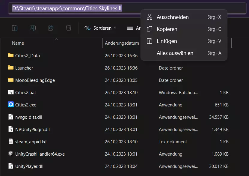
跳过Paradox启动器【已更新】
【指南/Steam/PC/Win10/Win11】如何跳过/避开Paradox启动器 步骤1:找到Cities2.exe 1. 在Steam库中右键点击《城市:…
2026-02-19 22:000赞 · 0评论
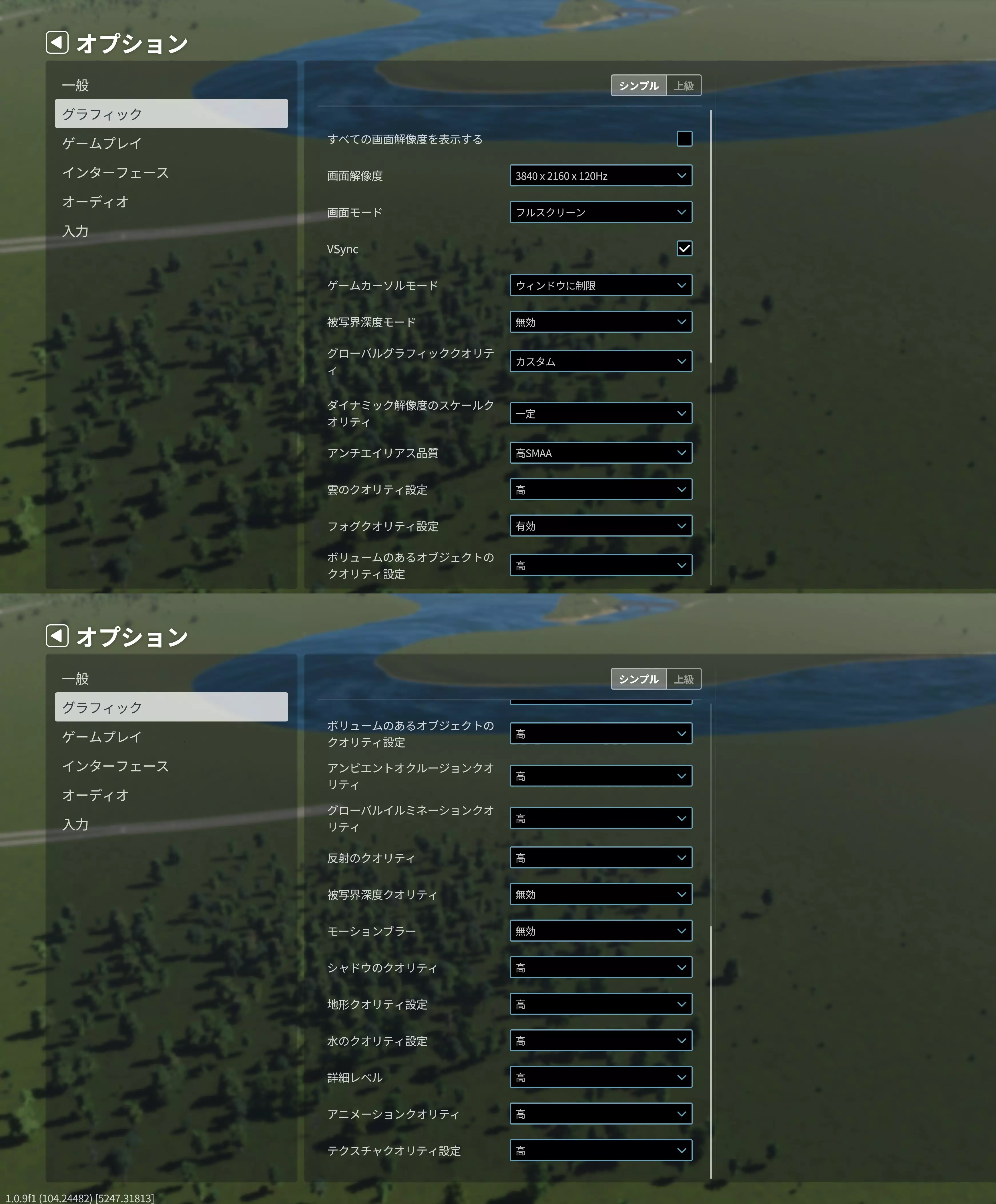
低帧率修复:如何提升性能(已针对桥梁DLC更新)
Tune your graphics settings to get the most FPS Introduction, test system This g…
2026-02-19 07:000赞 · 0评论
如何获取【I made this】成就
本指南将为你介绍如何获取【I made this】成就 获取方法: 1. 首先确保所有模组已禁用,或你正在使用支持成就的模组。 2. 启动编辑器
2026-02-18 04:000赞 · 0评论
城市角落#1 - 即将到来的视觉更新
各位市长,大家好! 新年快乐!随着2026年的到来,Iceflake团队想和大家分享关于首个补丁的开发进展。我们计划在每次版本更新之间发布多篇公告,这些公告将主…
2026-01-29 15:050赞 · 0评论
Paradox Interactive冬季特卖!
《城市:天际线》和《城市:天际线2》已加入Paradox Interactive冬季特卖活动!你可以以最高70%的折扣购买这些你喜爱的城市建造游戏,活动将持续到…
2025-12-18 18:000赞 · 0评论
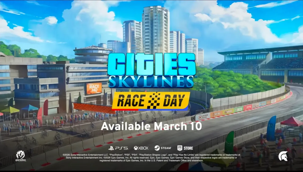
《城市:天际线》时隔两年迎来新DLC,「竞速日」3月10日上线
在《城市:天际线2》发售后历经波折的两年间持续调整(且原开发团队Colossal Order已不再参与系列开发)之际,发行商Paradox Interactiv…
2026-03-08 18:010赞 · 0评论
暂无更多
最新更新
- 《都市:天际线2》周边商品现已推出! — 《都市:天际线2》周边商品现已推出!我们与tilt_gaming合作推出了鼠标垫和手机壳,现已上市。
- 《都市:天际线2》城市角落#5 - 春季大扫除 — 各位市长好! 芬兰坦佩雷的积雪终于融化,现在正式向大家介绍我们的下一个更新补丁【春季大扫除】!这个即将推出的补丁包含一些新内容,以及对游戏玩法、界面和视觉效果的…
- 《都市:天际线2》Paradox Mods更新内容 — 来自Paradox Mods团队的问候! 欢迎阅读我们的第一篇开发日志!在过去的几个月里,我们一直在开发一些很棒的功能,我们非常高兴能向大家介绍下一次更新中的所…
- 《都市:天际线2》城市角落#4 - 性能初探 — 各位市长,大家好! 在本期城市专栏中,我们将深入探讨《都市:天际线2》的技术细节,尤其是游戏性能方面的内容。我们与技术总监和首席程序员进行了座谈,他们详细介绍了…
- 《都市:天际线2》办公进化与城市车站 - 现已推出! — 《都市:天际线2》今日加入周年庆典,推出全新内容及免费更新。
- 开发者日志 - 泰坦的办公区进化 — 大家好,我是泰坦! 可能有些玩家认识我——从《都市:天际线》发售首日起,我就一直是活跃的资产创作者,如今也在为《都市:天际线2》制作资产,还参与共创了【Germ…
- 开发日志 - 城市车站(Bad Peanut制作) — 大家好! 我是Bad Peanut,这是我为《都市:天际线2》制作的首个创作者包的开发日志。对于认识我的人来说,我这次回归初心,带来了一些公共交通相关的内容。对…
- 如何下载和安装《城市:天际线2》的模组 — 欢迎来到这份《城市:天际线2》模组综合指南!无论你是经验丰富的模组制作者,还是刚接触用户创作内容的新手,本指南都将帮助你查找、下载和安装模组,提升你的城市建设体…
- 玩《城市:天际线2》时如果感觉不适该怎么办 — 玩《城市:天际线2》时如果感觉不适该怎么办 突然之间,你城市里的每一次小堵车都像是一场巨大的灾难?你设计的那个环岛似乎在嘲笑你?你可能只是不适合进行城市规划了。…
- 如何跳过Paradox启动器 - 全平台通用方法 — 如何跳过Paradox启动器直接启动游戏,适用于Windows和Linux系统的指南 禁用启动器 原因:与其问为什么要禁用,不如问为什么不呢!它在启动游戏时除了…